Sierra Calderona: hiking and nature north of Valencia
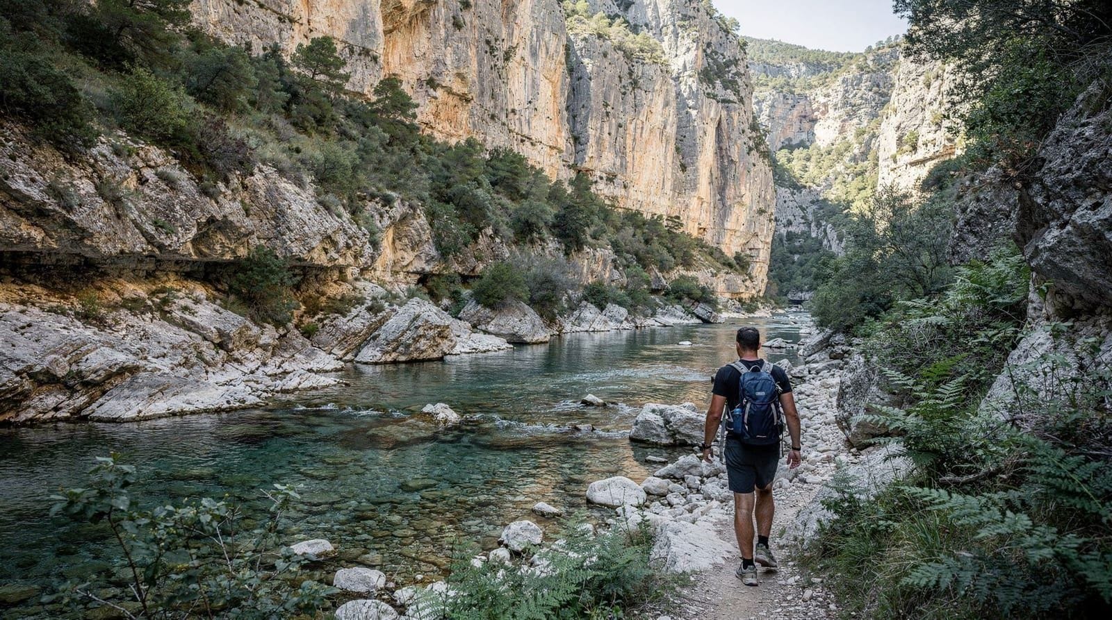
Valencia: Gorgos de Anna canyoning or hiking tour
What is the Sierra Calderona and is it worth visiting from Valencia?
The Sierra Calderona is a natural park of 47,450 hectares immediately north of Valencia — the closest mountain range to the city. It has pine and holm oak forest, several hiking trails, and small rural villages. A day trip takes 30–45 minutes from Valencia. Best for day walks and rural scenery rather than dramatic mountain landscapes.
The Sierra Calderona is the range of hills and low mountains immediately north of Valencia — visible on clear days from the city centre as a forested ridge above the flat coastal plain. At a maximum elevation of 692 metres (Pico Garbí), it is not a dramatic alpine landscape. What it offers instead is accessible forest walking, rural Valencian villages, and a complete change of terrain from the coast within 45 minutes of the city.
For visitors to Valencia who have more than 3–4 days, the Calderona provides the mountain contrast that the region’s landscape demands — the same relationship that the Alps have to Geneva, or the Serra de Tramuntana to Palma. Close, accessible, and genuinely different.
The park at a glance
Area: 47,450 hectares, extending from the coast inland through the municipalities of Bétera, Náquera, Serra, Gilet, Marines, and Segart.
Elevation: 100–692 metres. Garbí (692 m) and Creu de la Calderona (678 m) are the highest points.
Vegetation: Mediterranean scrub in the lower areas (rosemary, thyme, rock rose), transitioning to pine forest (Pinus halepensis, Pinus pinaster) in the mid-elevations, with holm oak (Quercus ilex) and gall oak in the upper sections. Wildflowers are exceptional in March–April.
Status: Natural park (Paraje Natural Municipal in some sections, Parc Natural de la Serra Calderona in others). Protected from development but open for hiking, mountain biking, and equestrian activities.
Main access points and villages
Serra: The largest village and the main gateway. At 320 metres elevation, with a castle ruin (Castillo de Serra) on the ridge above. Good services — several restaurants, a small supermarket, petrol station. The FGV train from Valencia Nord reaches Bétera, 12 km from Serra by road.
Gilet: A smaller village on the southern edge of the park, near the Montserrat gorge (different from the famous Catalan Montserrat). Several marked trails start from the village. The CV-25 road from Sagunto provides access.
Marines: In the western section of the park, at higher elevation. The area has more genuine mountain character and quieter trails than the southern access points.
Náquera: Adjacent to Bétera on the FGV line. The park boundary is walkable from the village. Less visited than Serra.
Hiking trails
Ruta del Castillo de Serra (8 km, medium)
Starting from Serra village, the trail climbs through pine forest to the ruins of the medieval Castillo de Serra (360 m elevation), then follows the ridge east with views over the coastal plain before descending via a different route back to the village. Approximately 3–4 hours return. Well-marked with yellow-and-white GR trail markers.
What you see: Ruined castle with good views toward Valencia city and the sea on clear days. Pine and holm oak forest. Several species of eagle and hawk are regularly observed from the ridge, which acts as a thermal flyway.
Pico Garbí circuit (12 km, demanding)
The park’s summit trail from Serra or from the road pass above Náquera. Elevation gain approximately 400 metres. Full circuit takes 4–5 hours. Views from the summit on clear days extend to the sea (30 km south), the city of Valencia, and on exceptional days to Ibiza.
This is the most demanding trail in the park and not suitable for children under 10 or casual walkers in inappropriate footwear.
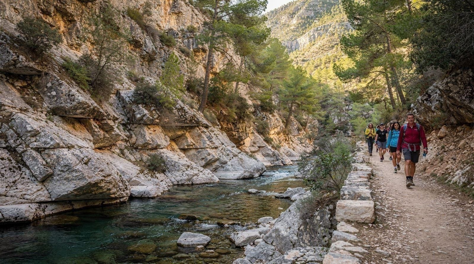
Montserrat gorge trail (5 km, easy-medium, from Gilet)
The Barranc de Montserrat trail follows a dry river gorge from Gilet into the hills, with impressive rock formations and good botanical interest in spring. Approximately 2.5 hours return. Mostly flat with some scrambling near the gorge head.
Good for: Families with older children, casual walkers who want scenery without significant elevation gain.
Short walks from Serra and Náquera
Several 2–4 km marked circular walks start from Serra town centre — suitable for an hour of walking before lunch. These are not dramatic but are pleasant and well-maintained. Maps available from the Serra town hall visitor information point.
 natural wonders — exploring the top 4 waterfallsCheck availability
Getting there
By car: The main route from Valencia is the A-7 north toward Barcelona, exit at Bétera/Náquera (approximately 20 km), then provincial roads. GPS to Serra: approximately 40 minutes from central Valencia. Parking in Serra and Gilet is free and usually available except on busy bank holiday weekends.
By train (FGV): The narrow-gauge FGV line runs from Valencia Nord to Bétera (25 minutes, ~€2 single). From Bétera, Serra is 12 km by road. A local taxi from Bétera to Serra costs approximately €12–15. This option is viable but requires planning the return carefully as train frequency decreases in the evening.
By bus: Limited regional bus services connect Valencia to some park villages, but frequencies are designed for school runs and commuter hours rather than tourism. Not a reliable option for day trips.
What to bring
For a half-day hike in the Sierra Calderona:
- Walking shoes with grip (trail runners or light hiking boots — not road shoes on the steeper trails)
- Minimum 2 litres of water per person (no reliable water sources on the main trails)
- Food for a long walk — the Serra restaurants are good for lunch before or after, but there is nothing on the trail
- Sun protection (the forest is partial shade; exposed ridge sections are intense in summer)
- A printed or offline trail map (phone signal is variable in the upper sections)
- Light jacket for the upper trails (temperature drops 5–7°C from village to summit)
When to visit
Spring (March–May): The best season. Wildflowers cover the scrub areas, temperatures are ideal for walking (12–22°C), and the forest smells of thyme and rosemary. The winter rains have filled any seasonal water features.
Summer (June–August): Walking before 10:00 is manageable. By midday, temperatures on exposed ridge sections reach 30–35°C. Reserve summer visits for early morning or late afternoon. The fire risk (risc d’incendi) is high — several trail sections may be closed from June to October during high-risk periods. Check the Generalitat Valenciana fire risk notifications before setting out.
Autumn (September–November): Excellent. Mushroom season from October onwards attracts local foragers. The forest turns well in November. Wild boar are active in autumn and can be heard even if rarely seen.
Winter (December–February): Cool, often clear, and quiet. The park is virtually visitor-free on winter weekdays. Snow on the upper sections is rare but does occur once or twice per winter. A winter morning hike on Pico Garbí with coastal views in clear air is one of the region’s underappreciated experiences.
 Gorgos de Anna canyoning or hiking tourCheck availability
Honest assessment
The Sierra Calderona is not a destination that will make most visitors change their travel plans to include it. It is not the dramatic scenery of the Pyrenees, the Dolomites, or even the Sierra Nevada. It is a gentle, forested range of hills that provides an honest contrast to the coast.
Its value is contextual and immediate: if you are in Valencia for 4–5 days and have covered the city’s main attractions, an afternoon in the Calderona refreshes the palette. The 40-minute drive, the forest walking, the quiet village lunch, and the return to the city by early evening make a satisfying and low-effort day. It is the kind of destination that rewards visitors who are paying attention to the whole landscape of a region rather than just its highlights.
For more demanding mountain or gorge experiences from Valencia, see the Montanejos guide (thermal pools, limestone gorge) and the day trips guide. For coastal nature, see the Albufera Natural Park guide.
Frequently asked questions about Sierra Calderona
How far is the Sierra Calderona from Valencia?
The park boundary begins approximately 20 km north of Valencia city. The village of Serra (a main access point) is 35 km from the city centre — about 40 minutes by car. Some northern sections are further, up to 60 km from Valencia.What are the best hiking trails in the Sierra Calderona?
The main routes start from Serra, Gilet, and Marines. The Serra castle circuit (Ruta del Castillo de Serra) is approximately 8 km and rated medium difficulty. The Pico Garbí trail (maximum elevation 640 m) is the most demanding option, with good views toward the coast. Several shorter marked trails run from Gilet along the river gorge.What wildlife can you see in the Sierra Calderona?
Golden eagles, Bonelli's eagles, peregrine falcons, and short-toed snake eagles are all resident. Wild boar are common but rarely seen in daylight. Stone martens, badgers, and various reptiles including the ocellated lizard inhabit the forest. Wildflower coverage is excellent in spring.Can you visit Sierra Calderona without a car?
Marginally. Trains on the FGV line (Ferrocarrils de la Generalitat Valenciana) from Valencia Nord connect to Bétera and Marines, both on the park's southern edge. From these stations, the trail access requires additional walking (3–5 km) or local taxi. A car makes access to the best areas significantly easier.Is Sierra Calderona good for families with children?
The gentler trails around Gilet and the Montserrat gorge are appropriate for children aged 7+. The main Garbí summit trail is demanding for young children. The villages within the park have small squares and bars suitable for a lunch break.
Top experiences
Bookable activities with verified prices and instant confirmation on GetYourGuide.